Lele Hot Springs

Lele Hot Springs

Nantou (南投縣), Taiwan’s only landlocked county, is where I first fell in love with the island, a few months after arriving here in 1993, when I got a job in an English cram school in a rural part of the county. It’s also one of the richest and most spectacular parts of the country for hikers, river tracers and other nature lovers.

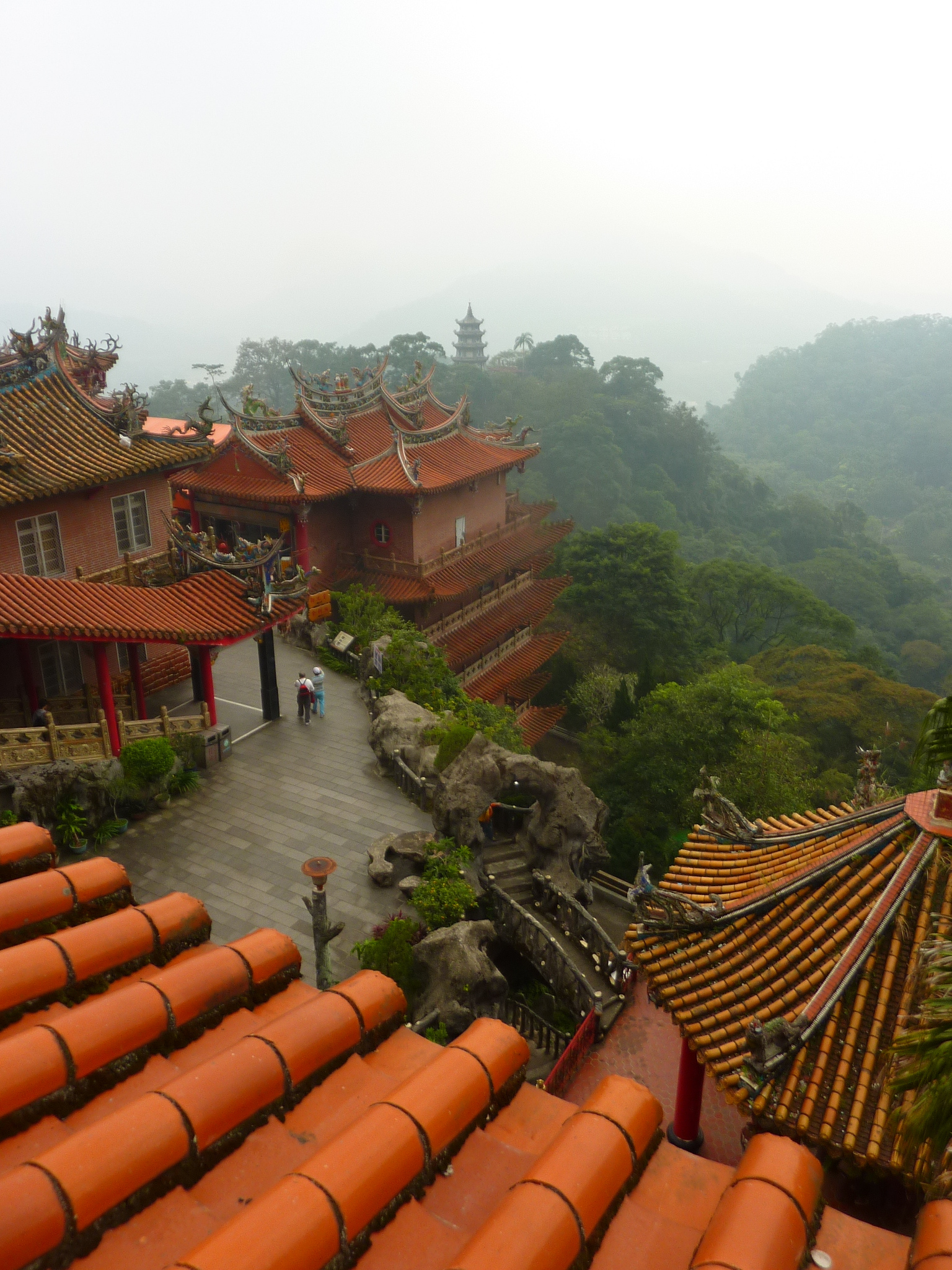
For most tourists, the attractions of Nantou County start and end with Sun Moon Lake (日月潭), a lovely place that has become one of Taiwan’s top tourist draws. Some also get to the Forest Recreation Area at Xitou (溪頭), and since opening in 2005, the Heavenly Steps () suspension bridge at Zhushan (竹山) has been a huge draw among locals. It’s worth mentioning though that what we can see along the Heavenly Steps trail today is a very pale shadow of the true wonders of the (presently inaccessible) main part of Taiji Canyon (太極峽谷) a kilometer or two downstream.  When (or rather if) that awe-inspiring place ever reopens to hikers, it will be a major cause for celebration.

Among its other tourist draws, Nantou County has more than its fair share of hot springs, although they’ve taken a bit of a battering in recent years. The springs at Aowanda (奧萬大) near Wushe (霧社) in the north of the county) are now all but gone, and most of the crowds visiting the Forest Recreation Area are there either for the cool mountain air, or for the spectacular display of autumn colors (probably Taiwan’s finest), put on each winter by the forests of maple trees in the park. Lushan Hot Spring (盧山溫泉; Chiang Kai-shek’s favorite spa) survives, despite damage caused by a series of typhoons in recent years, and several other hot springs sources in this part of Nantou have been tapped to supply smaller-scale resorts and bath houses.  

For such a rugged part of the island, it’s quite surprising that so many of Nantou’s hot spring sources have been developed. Happily, a couple do survive in all their splendidly untouched, natural beauty.  Just below Lushan (the aboriginal village area, not the hot spring resort downstream), Jingying Hot Spring (精英溫泉), although never formally developed, can be reached by a bumpy one-track road, and is besieged on weekends. A short clamber upstream a couple of small sources have, however, escaped attention and remain attractively untouched, and a kilometer or two further upstream, the beautiful Yunhai Hot Spring (雲海溫泉) is unknown to all but keen hikers, as getting up there involves scaling a couple of vertical dam walls on fixed ropes. [Since my last visit to Yunhai in 2017, it seems, from photos I’ve seen recently, that access to the hot springs might be easier now before, as ladders and foot holds could have been added to the dam walls].

Easier to reach, yet still strenuous and awkward enough to keep all but fit hikers out, Lelegu Hot Spring (樂樂谷溫泉) lies in the deep gorge below Nantou’s second hot spring resort, Dongpu (東埔). The slightly odd name (which means “happy happy valley”) is in fact a transliteration of the original Bunan aboriginal name for the hot spring, Laku Laku, which represents the sound of the pressurized, boiling-hot water as it bubbles out of rock faces in the gorge, just above the river.

Before planning a trip to Lelegu Hot Springs, note that the place is one of many around the island that are officially off-limits to general visitors, yet remain very popular with hikers, so if you go, you do so at your own risk. The hot springs are accessible year-round, but the best time is December to late April, not only because of the cooler weather, but also because the river level will be lower, making the hike more straightforward. Definitely don’t attempt to visit for several weeks after a typhoon. 

Start the journey at Dongpu, the main drag of which is lined with hot spring hotels. Walk straight past these and follow the road, contouring the hillside, through a tunnel, and on to a residential area beyond, where fruit and veg are farmed on the flat alluvial plain at the foot of the gorge.

On the left is the modern trailhead of Batongguan Historic Trail (八通關古道), and for the first hour of the hike, follow it, first zigzagging steeply upwards, then round the sheer, severely eroded bluffs of Father and Son Cliff (父不知子斷崖). About twenty minutes after the cliff, there’s a fork, marked by a red warning sign familiar to anyone who hikes a lot along Taiwan’s less popular trails. Turn right.Officially there’s a NT$3,000 fine for going any further down this side path. In practice, many local (and foreign) hikers still visit the hot spring each year without incident. I’m not saying that you should ignore the sign, but let’s say similar signs stand at the start of the trails to many of Taiwan’s most fantastic places, and many hikers read them as warnings that trail conditions ahead are poor, and take appropriate care, rather than prohibitions banning anyone from using the trails. The trail that descends into the gorge. At first, it’s clear and wide, but soon narrows, and although easy enough to follow, it’s steep in parts, and the thick layer of loose leaf mold makes for slippery footing, so take care!

The trail zigzags down the precipitous face of the gorge, with one or two relatively easy scrambles. At the bottom the trail veers left and levels out, finally reaching the river bank just upstream from a rocky defile through which the water seethes, even during the dry season. 

Now simply follow the boulder-strewn left bank of the river. Cairns mark the best route through the maze of huge boulders, rock faces and thickets of tall grass. Keep high and well to the left as the river falls over a small waterfall and rages through a small gorge, and the first hot spring sources are in the rock face on the left just a little further upstream. The water emerges from the cliff at a perfect temperature for a bath, and there’s usually a pool or two, made from rocks, left by earlier hikers.

About a hundred meters upstream is a second area of hot spring sources, spluttering furiously out of the cliff, emitting large clouds of steam, and far too hot to dip even a toe into. Be careful where you tread in this area, as the water is close to boiling point in many places.

Continue another five minutes upstream (this last bit is impossible during the wet season), and more hot spring sources sputter out of the rock into a series of pools. You almost certainly won’t be alone here if you come on a weekend, but it’s a beautiful spot, and you’ll definitely feel happy happy!

Pingxi Sky Lanterns: a Blot on the Landscape

NOTE: This article was written on October 4th, 2017. By the time I returned home to England in the summer of 2018 there was increasing talk about starting to produce less harmful, bio-degradable sky lanterns, but I haven’t heard if it came to anything. I’d be interested to hear the latest news.

Tonight, the Pingxi Sky Lantern Festival (坪溪天燈節活動) will be held for the second time this year, to celebrate the Mid-autumn Festival, so it’s perhaps the perfect time to consider this controversial activity, and the impact it is having on the local environment.

It’s said that Pingxi’s sky lanterns were first used as a kind of early warning device to alarm local residents when bandits were in the area, so the activity is rooted in historical practice. Unfortunately, this original cultural/historical significance seems to have been lost on many visitors, who release the lanterns year-round these days (and often in large quantities on weekends). In my opinion, the lanterns have instead become a kind of symbol of the selfie-generation. For many tourists I’ve witnessed over the years at Pingxi (平溪) and nearby Shifen (十分), the object of the activity appears to be to have fun with friends, painting messages on the side in the slightly bizarre idea that they’ll then be carried to the gods, take a few selfie shots with the lantern in the background, wow and whoop as said lantern ascends into the air, and then post some pics on social media. It’s harmless entertainment, and this would be perfectly fine, if only it didn’t cause so much harm to the surrounding countryside.

The presumption that all (or even the majority) of the lanterns can be found and cleared up is frankly a naive and fundamentally flawed one, as anyone who knows the rugged topography of the area will immediately realize. Most sky lanterns don’t obediently fall beside trails ready to be picked up by clean-up crews. From personal experience, even those that do fall in easily accessible places sometimes don’t get picked up for weeks, maybe even months. The majority instead fall far from any trail, in often inaccessible places, where they’re left to rot. Or at least the bits that can rot are left to decompose. During several clear-ups of the area over the last few years, we’ve found quite a few abandoned lanterns (all within easy reach of good trails) that had wire frames inside, which won’t decompose for decades or even longer, and meanwhile pose a threat to wildlife as well as being a stain on the beauty of a very special landscape.  The glaze used on the paper and the ink used to paint messages on the side of the lantern also contain chemicals that probably aren’t good for the environment.

I sympathize with those that love to release sky lanterns – it’s a magical activity while the lantern is lit, released, and floats up into the sky, but the truth is that it’s highly – no, extremely – unlikely that your lantern will ever be picked up and disposed of in the correct matter. 

A major argument in favor of continuing the year-round sale of sky lanterns is that they’ve become a hot tourist draw, and the money they bring in is a major boost to the local economy. However, the upper Keelung Valley, in which Pingxi lies, is an area of uncommon scenic and cultural interest, with a whole clutch of spectacular waterfalls, some of the finest hiking in New Taipei City, several atmospheric, historic villages with good local food, an interesting history, and its own quaint branch railway line. Even without the sky lanterns, the area won’t have a major challenge attracting tourists.

I certainly don’t think releasing sky lanterns should be banned outright, even if that were possible. Instead I’d suggest the activity (lanterns are presently released throughout the year) is limited to two annual events: the Lantern Festival and tonight’s Mid-autumn Festival celebration, when limited numbers will be released in relatively controlled conditions. In that way a much-loved activity could continue, the number of lanterns littering the surrounding landscape will decline dramatically, and this stunning corner of our beautiful island will hopefully start to recover from the ever-increasing onslaught of trash that’s threatening to destroy its enchanting beauty.

LION’S HEAD MOUNTAIN (Miaoli)

LION’S HEAD MOUNTAIN (Miaoli)

A guaranteed highlight of any visit to China is spending a day or two exploring one of its amazing sacred mountains: those lofty eminences shrouded in a misty veil for much of the year, studded with ancient monasteries inhabited by grizzled old monks, and chockablock with stunning vistas, cloud-kissing peaks, and the occasional hanging monastery clinging to a sheer cliff face. Lion’s Head Mountain (Shitoushan; 獅頭山) is Taiwan’s answer to amazing Buddhist (and Taoist) sacred mountains in the Middle Kingdom such as Huashan, Emeishan or Mt. Jiuhua, and while you’ll won’t see wizened old monks or centuries-old buildings on your visit, it’s a very special place in its quieter, less spectacular way. 

   While Lion’s Head Mountain is still only beginning to appear on the radar of foreign expats and tourists, it’s far from being off-the-beaten-track among the Taiwanese, attracting crowds on sunny weekends.  Not even hordes of people, however, can spoil the beauty and unique atmosphere of this rather special place. For all its popularity, Lion’s Head Mountain covers a large area, with many kilometers of marked trails, and only at peak times are the most popular paths likely to seem too crowded for comfort.

   Lion’s Head Mountain, about 25 kilometers’ drive south of Hsinchu city, is one third of the Tri-Mountain National Scenic Area (叁山國家風景區), established in March 2001 to protect three upland regions in central Taiwan.  The other two are Lishan (梨山), in eastern Taichung City, and the Mt. Bagua (八卦山) range of hills near Changhua.  This last is another major draw for the island’s Buddhists; a temple in the hills here right above Changhua city has a famous, 22 meter-high black statue of the sitting Buddha.  

   Lion’s Head Mountain is a rocky eminence, and most of the main temples on the mountain are built into small natural caves or overhangs in the rock face. The largest is Shueilien Cave (水簾洞; Water Curtain Cave), close to Lion’s Head Mountain Scenic Area Visitor Center, on the lion’s “tail.”  The walk down to the temple, through the small but attractive gorge of the Shijing Stream, is nice, but the cave itself is aesthetically challenged; its main feature is a tall and very ugly wall, which detracts from the beauty of its cave setting. Downstream (but reached by a different trail from the road above) is the very short (half-kilometer-long) “Sticky Rice” Bridge Walk (糯米橋步道). This is a more scenic experience, dropping into a short length of especially narrow and dark gorge, crossed by a century-old bridge, the stone blocks of which are cemented together with mortar made from (believe it or not!) a mixture of rice, brown sugar and lime! 

   Almost opposite the trailhead of the sticky rice bridge trail, a road passing through a temple gate is the start of the walking route that connects most of the temples on the ridge, from “tail” to “head.” If you’re short of time (or energy) the temples on this side (and the “trail,” which is a surfaced road most of the way) can be safely skipped, to allow more time at the opposite end of the ridge. This is the setting for Lion’s Head Mountain’s most impressive set of temples, and to reach it drive or catch a shuttle bus from the visitor center. Here at the lion’s “head,” nestling on the steep, densely forested mountainside high above a large car park, is probably the most aesthetically pleasing ensemble of temples and monasteries on Taiwan.

   The main structure of the group, Qinhua Tang (勤化堂), is a magnificent edifice of classical Chinese prayer halls, pagodas and gates, each crowned with bright orange-tiled roofs which shine in the sunlight. It’s complimented by a series of smaller structures, including the Morality Gate (道德門), Kaishan Temple (開善寺), and Lingyun Cave (凌雲洞), which all share the same photogenic classical architecture (reinforced concrete and uninspired functionality are almost nowhere to be seen) and combine to create a truly impressive scene. A couple of the temples, such as Lingxia Cave (靈霞洞), which has a florid, baroque façade, even show distinctly Western influences.

   The ensemble looks beautiful from the car park below, but to get a closer look, take the steps up to Qinhua Tang, after which the path is more-or-less level along the base of the cliffs, passing a succession of temples built into caves and natural overhangs at the base of the rock.  After the fine Morality Gate, the path climbs again, steeply at first, but this is a lamb in lion’s clothing, and it’s a fairly easy and brief climb to the base of the impressive Shishan Rock Face (獅山大石壁, below), near the summit of the mountain. Turn left here and you’ll probably have the path to yourself as it follows the base of this lofty and impressive wall of rock. It eventually loops round and rejoins the outward route at the Morality Gate, passing a string of peaceful, little-visited cave temples on the way. 


Huisun Hot Springs

Landlocked Nantou County lies at the heart of Taiwan in several senses. It’s the island’s geographical center, has a rich aboriginal culture, and is a showcase of much traditional Chinese and Taiwanese heritage too. For hikers, it has also some of the island’s most stunning scenery. Forget the over-rated charms of Sun Moon Lake, which is lovely, but way too developed. Instead, head for the county’s true scenic wonders, including Batongguan Historic Trail (八通關古道) and (if the trail into the best part of it ever re-opens) Taiji Gorge (太極峽谷); both are magnificent.

Huisun Hot Springs lie, uniquely, in a small cave halfway up a cliff face!

   Up there among Nantou County’s greatest destinations, although a lot less well-known than most, Huisun Hot Spring (惠蓀溫泉) is possibly unique among Taiwan’s natural hot spring sources, since it lies in a small cave set into a sheer cliff face about eight meters above the surface of a fast-flowing river. The hot spring itself is fascinating, but the real highlight is the tough journey to it, which, although a bit problematical, is a real adventure, and a stunningly scenic one.

The hot springs are impossible to reach from the first plum rains (usually in May) until the beginning of the following year, and even during the dry season there’s no guarantee of making it. We succeeded on our second crack, in February, although even then the water was uncomfortably deep and fast-flowing in places. A couple of weeks later a group of friends tried, and couldn’t even start the river trace because the water was too high.

The entrance to the little hot spring cave

The jumping-off place for the hot springs is Huisun Forest Recreation Area (惠蓀林場), and a lane branching sharply off the main road through it, six hundred meters after the service center. Walk up this road, pass around the gate at the top, and follow the wide track downhill into the deep river valley beyond. The track is carved into sheer cliffs, so watch out for falling rocks! A group of Atayal aborigine locals we met here warned us of monkeys throwing rocks down on people as they walked along the road. It sounded like a joke, but we had exactly the same warning from some Truku aboriginal guides when entering another of Taiwan’s great scenic wonders, the Golden Grotto (黃金峽谷) in Hualien County, so they might just have been serious!

The road crosses the river by a very large bridge, and after it narrows to a trail, descending to the river, and the start of the exciting river trace up to the hot spring.

You’ll need to cross the river immediately, and if this first river crossing feels at all unsteady or risky, turn back immediately – the river crossings get trickier further up!

The scenery is already very impressive, with huge crumbling cliffs rising several hundred meters above the river in places. Look out for several small hot spring pools on the riverbank as you make your way upstream.

After about an hour, the trip really starts getting exciting, as the gorge narrows greatly, and the water is squeezed into the first of a series of awesome canyons (photo above), flowing deep and fast through them. Expect to be wading waist deep in many places.

Further upstream rock faces are stained by tiny trickles of hot spring water oozing out, and further tight, awesomely sheer gorges, through which the river runs swift and deep, make it a spectacular trip. A magnificent waterfall – a tall, narrow plume of water the better part of a hundred meters high plunging straight into the river – is a highlight.

After the waterfall, the hardest part is over. More startlingly bright colors stain the rock faces of the gorge in several places as small hot spring sources seep out of the cliffs. The gorge widens, and becomes far less impressive. In another couple of hundred meters, however, the river narrows and becomes more rugged again, and on the right a small cave in the cliff conceals Huisun Hot Spring. Climb up the short rock face, and the cave holds a pool of bright green, bath-hot water, which trickles out of cracks in the back of the cavity. On our visit a colony of tiny bees had set up residence here, and buzzed harmlessly around our heads as we soaked, trying not to think of the long, tough river trace back to civilization!

Huisun Hot Springs is a tough and slightly risky place to get to these days; don’t underestimate the trip, and be sure to check the weather forecast before you go. Don’t even think of attempting to go before early February, when the water level has (usually) receded enough to make an attempt safe, and be prepared to cancel the trip if the going looks dodgy early on. The trip normally becomes impassible once again a couple of months later, in mid April, as the first rains of the plum season begin. Start early!! It’s a long way out and back in one day, and camping or carrying heavy, bulky backpacks in the narrow canyon is a bad idea. A gravel track which once made the trip relatively easy (it was even used by mountain bikes!) has long since been washed away by typhoon floods. A few short, overgrown stretches remain (look out for these – they’re all on the right as you work your way upstream), and you’ll need to use them all to reach the hot spring and get back in one (long) day.

Get an early start by camping in or near Huisun Forest Recreation Area. Officially camping isn’t allowed inside the FRA, but in practice campers set up in car parks or quiet spots near the road after dark, and as long as they’re gone soon after dawn, there’s rarely a problem. It’s best to do this in fact, because the Recreation Area (which isn’t open 24 hours) opens at 8:30 am for day-trippers, making it a rather late start for a tiring day.

The Stone Candle (石燭尖), Pingxi

NOTE: This article was written in 2017, so conditions may have changed since

The Stone Candle, as seen from the rocky peak next to it

  The little village of Pingxi (平溪) is synonymous with sky lanterns these days, so it’s only too easy to forget there’s actually a great deal more to do in the area, especially if you’re a walker! The three Pingxi Crags (Filial Son (孝子山), Loving Mother (慈母峰) and Mount Putuo (普陀山)) have also become very popular in recent years, as people discover this amazing adult adventure playground of rocky pinnacles and whaleback rocks and head out there to see if they are, indeed, real. For the reasonably fit hiker, however, the Pingxi Crags are just one of a whole range of excellent routes of varying difficulty in the mountains around Pingxi village, and a rather more environmentally friendly way to spend your day than releasing a sky lantern.

   Standing in the center of Pingxi village and looking around, it’s already pretty clear that the local landscape is rugged, rocky, and densely wooded, and at first glance it might seem that much of the area is inaccessible to the average hiker. And indeed it is, which is why sky lanterns, when they finally float back to earth, usually stay there, often for years, as the wire frames slowly rust away. However, some surprisingly wild-looking places can be reached relatively easily from the village. The Stone Bamboo Shoot (石筍尖) is the toothy-looking chunk of rock that sticks conspicuously out of the ridge to the north of the village. At first it appears to be a very steep and possibly technical climb, but following “improvements” made to the trail over a decade ago, two formally rather tricky spots are now much easier to pass, and it’s a relatively simple hike to the top from Pingxi. The views from up there are extraordinary.

The view from the summit of the peak

   Some of the area’s finest summits, however, are invisible from the road, and take a bit more searching out. I hope to highlight a few of the finest hikes in the area in future Off the Beaten Track installments. First though, I’d like to introduce the short but mildly adventurous hike to one of the least-known yet most distinctive natural landmarks within easy reach of the village: the Stone Candle (石燭尖). It’s true that the Pingxi area may lack the huge, wide-open spaces of Yangmingshan National Park, or the dramatic mini-mountains of the area around Jinguashi (金瓜石) on the northeast coast, but with so many fun, exciting hikes like this one, few places in northern Taiwan can hold a candle (so to speak) to this little corner of New Taipei City.

The wonderful needle of rock known as the Stone Candle is the pointiest of the many arresting peaks of rock (or “pitons” as the Chinese is oddly translated on maps) that jut out of these forest-covered hills. Although little known, it’s not too far from the road. However, distance in Taiwan is often little help in determining how difficult or how long a hike will be. A signpost at the trailhead suggests the Stone Candle is just thirty minutes away, but for the average mortal soul, this timing (like several others in the area) is very inaccurate. Several fairly steep climbs and a narrow, rocky ledge or two make getting to the Stone Candle a fun but surprisingly rough short adventure, so allow about an hour each way.

Three shallow caves have been hewn into the cliff on the climb up to the Stone Candle

   The trail starts opposite Pingxi Lower High School, just west of the village center. Climb the steps that scale the bank beside the road, and at the top ignore a second set of steps, instead bearing right along a dirt trail through a wooded gorge, above a stream. Soon the gorge opens out, and the trail wanders past an area of allotments and a house. Re-entering the gorge, the trail crosses the stream at a small concrete dam. The small pool it creates is a great place for a quick cool-off on a hot summer day. Continue upstream through rather beautiful little glen, and in about five minutes the trail veers right up a very long flight of stone-slab steps, covered in a thick layer of bright green moss.

   Now the fun begins as a slippery dirt trail continues upwards from the top of the steps, climbing through the jungle to the base of a long, vertical cliff, with three shallow caves artificially carved into its face. The trail now climbs steeply along the foot of this impressive rock face to connect with a short knife-edge ridge leading up onto the peak. It’s safer since several rough “steps” were cut into the blade of rock, but for less confident hikers there’s an alternative, easier route to the left along the bottom of the narrow ridge. The two trails rejoin just before the Stone Candle.

The mossy steps leading up to the rock shelters

   Finally, the jungle falls away to reveal a sloping rock face, dropping away vertically on the far side, at the summit of the peak immediately in front of the Stone Candle. The top of the spiky rock formation looms ahead, but to see the whole thing, wriggle up to the brink and peer over the edge. Beyond, looming out of the thick jungle ten or twenty meters away is a slim and very pointed tower of rock about 35 meters tall, the Stone Candle itself. A side trail around the foot of the ridge leads to the base of the pinnacle, but it looks much less impressive from below, so spend your time peering across at it from up on top, while not forgetting to enjoy the fantastic views over Pingxi, the shapely summits of Shulung Peak (薯榔尖) and the Stone Bamboo Shoot (石筍尖), and the verdant green valley of the upper Keelung River, far below.

Near the trailhead

Off the Beaten Track is Back Online!

After a break of over two years, and being offline for many months, I’m back! The new, improved Off the Beaten Track site was permanently deleted by the domain provider after a paltry, month-long period of grace (along with about eighteen months of blog posts), long before I realized I’d forgotten to update my payment methods, but the original WordPress site survives, and I’m intending to revive it with occasional ‘new’ posts from pieces I wrote (and saved) during my last two years on Taiwan. I moved permanently back to England in July 2018, and after vainly hoping for six months to get my new trekking outfit Trek Taiwan up and running, I accepted the fact that I was back in the UK to stay, and gave up those plans. In hindsight it was unfortunate timing, since I’m now confined to my home in rural Wiltshire (not far from Stonehenge and Bath) while a global pandemic rages (while back in Covid-free Taiwan, my old friends continue to live – and hike – as though nothing was happening!) However, much as I miss Taiwan, Britain offers way more than enough to keep me busy hiking and exploring for at least a couple more decades before I even start to feel like I really know my home country.

A bit older now, but just as happy back home in England!

While cooped up at home I’m planning to top up this blog with some articles written during those last two years in Taiwan and not yet posted on this blog. . I’m now working as a peripatetic piano teacher in local schools, and since I get the same lovely long holidays I enjoyed in Taiwan, I’ll be back in Taiwan for a summer’s adventure, revisiting some old favorites and discovering lots of new places. This almost certainly won’t happen until 2021, but when it does, I’ll have some new fodder for this blog. Can’t wait!

Taiwan’s Top Hundred Peaks: 2. Eight Easier Treks

dsc02019

Yushan, Taiwan’s highest mountain, is also one of its easiest to climb

OLYMPUS DIGITAL CAMERA

Mountains in Taiwan are famous for their sunrises, but often it’s the sunsets that are the most unforgettable

img_0336

Early morning on Mount Tao, Wuling Quadruple

OLYMPUS DIGITAL CAMERA

Jade Mountain is both an exciting climb and a surprisingly easy one

Let me start by saying I’m no expert at hiking Taiwan’s high mountains! Of the Top 100 Peaks (a list of one-hundred mountain peaks from the 270-odd summits in Taiwan that exceed 3,000 meters in height), I’ve so far only done 29 – a lot less than some hiker friends of mine. However I’m acutely aware that starting out on the Top Hundred can be be a bit daunting – the difficulty of the peaks on the list varies hugely, and while two or three summits on the list are within the ability of all able-bodied people, and a further ten or twenty can be conquered by anyone that’s reasonably fit and has a few Taiwan day-hikes under their belt, after that the difficulty level quickly goes through the roof, and inexperienced hikers could easily find themselves in serious trouble if they pick the wrong trek. Continue reading

Mount Baiguda (白姑大山; 3, 341 meters)

OLYMPUS DIGITAL CAMERA

The deceptively gentle-looking summit peak of Mount Baiguda

OLYMPUS DIGITAL CAMERA

Dusk at Siyan campsite, day one

OLYMPUS DIGITAL CAMERA

On the crags which lead to the final climb to the summit

OLYMPUS DIGITAL CAMERA

OLYMPUS DIGITAL CAMERA

Ancient trees (both standing and fallen) are a dominant feature of the trail to Mount Baiguda

Mount Baiguda (3,341 meters, no 45 on the ‘Top Hundred’ list) on the border between Nantou County and Taichung City doesn’t seem to get nearly as much love as some of the other summits on Taiwan’s Hundred Peaks list. Permission to climb is easy to get (only a police permit is required), yet there were few other people up there this last weekend, despite the absolutely perfect weather. It’s among the tougher peaks on the list I’ve done to date, especially since we did it in 2 days (meaning a 14-to-16-hour second day of hiking!), but it amazed us all with its beauty. Photos I’ve seen on blogs and elsewhere are usually of the deceptively gentle, rounded, wooded summit dome, which looks boring as anything, but is in fact steep and very rocky, with a stellar 360-degree view from the top. Even more rewarding are the series of crags which the trail follows on the way to the final slog up to the summit peak – nothing technical or difficult, but plenty of tough, knee-breaking  ups and downs, and absolutely stunning views over the surrounding wilderness. Definitely one of my top five high mountains so far, and among the tougher ones too! Continue reading

Taiwan’s Top Hundred Peaks: 1. Getting Started

OLYMPUS DIGITAL CAMERA

Mount Yingzui in eastern Taichung City is the perfect place to get fit (and a bit of experience) for Taiwan’s high mountains

OLYMPUS DIGITAL CAMERA

Around Taipei, The Bat Cave is a compulsory part of a trip to Huangdidian, since it’s the hardest landmark on the ridge to get to.

OLYMPUS DIGITAL CAMERA

Mount Wuwowei is the steepest and probably most interesting of the Guguan Seven Heroes, and with a thousand meters of vertical ascent, it’s a great day hike for boosting stamina and endurance.

Anyone who’s even a bit serious about hiking in Taiwan will sooner or later make a start on the island’s greatest and most tempting hiking challenge: the Top One Hundred Peaks (百岳).

OLYMPUS DIGITAL CAMERA

Negotiating a slippery obstacle on the Fengtoujian Ridge hike

Hiking, like hot spring bathing, was pioneered in Taiwan by the Japanese, who made first ascents and established trails up the island’s tallest mountains, Jade and Snow, and first coined the term “Holy Ridge” to describe one of the island’s most iconic high mountain routes. The small but extraordinarily rugged island of Taiwan is said to have the highest density of high mountains of any country in the world, with 286 named summits over 3,000 meters (10,000 feet) – far more than most mountain climbers are likely to conquer, especially considering how remote and inaccessible many of them are. Perhaps it was because of this that in 1971 members of local hiking clubs made a list of the “top hundred peaks,” a selection of the 3,000 meter-plus mountain summits they considered the finest, most distinctive, most beautiful, and generally worthiest of climbing. Continue reading

Taiwan’s Wild Hot Springs 2: The Central Cross-island Highway

Waterfall on the way to Maling Hot Springs, Guguan, on the Taichung side of the highway

Waterfall on the way to Maling Hot Springs, Guguan, on the Taichung side of the highway

The beautiful marble canyon at Wenshan Hot Springs, Taroko Gorge

The beautiful marble canyon at Wenshan Hot Springs, Taroko Gorge

The beautiful Central Cross-island Highway, which once linked the cities of Taichung on the flat western plains of Taiwan, and Hualien, below the towering mountains and sea cliffs of the island’s east coast is, like the North Cross-island Highway, graced with a number of fabulous hot springs. Like their northern counterparts, developed resorts (at Guguan) can be found, but the remaining three main hot springs along the highway remain pristine, and fabulously scenic to boot. Continue reading